 WeeklyTrail
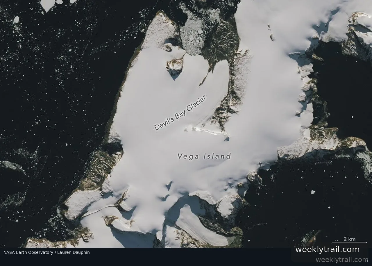
NASA Earth Observatory published Landsat 9 images of Vega Island, in the Weddell Sea east of the Antarctic Peninsula, comparing the ice-covered island in March 2025 with October 2026. Ice, rock outcrops and glacial moraines give part of the island the appearance of a grinning skull in profile, with a nunatak resembling an eye socket and a lateral moraine forming a mouth. Bahía del Diablo Glacier serves as the jawbone.
The March 2025 view shows a snow coating typical of the region's wettest month. In October 2026, snow was absent from large areas, exposing darker bare ice. Glaciologist Mauri Pelto of Nichols College said above-average winter 2026 temperatures, particularly in June, were partly responsible, and that exposed ice indicates limited new snow accumulation over the winter, further reduced by sublimation and wind scouring. Because bare ice absorbs more solar energy than snow, Pelto said melting is poised to speed up as days lengthen and warm.
A 1982 study catalogued 29 glaciers on Vega Island using early Landsat observations along with aerial photos and topographic maps. Devil's Bay Glacier has been monitored since the austral summer of 1998–1999, with researchers measuring an overall decline in its mass, and later satellite images show ice loss from other glaciers with more exposed bedrock.


Start the conversation. A good question is half the story.