 WeeklyTrail
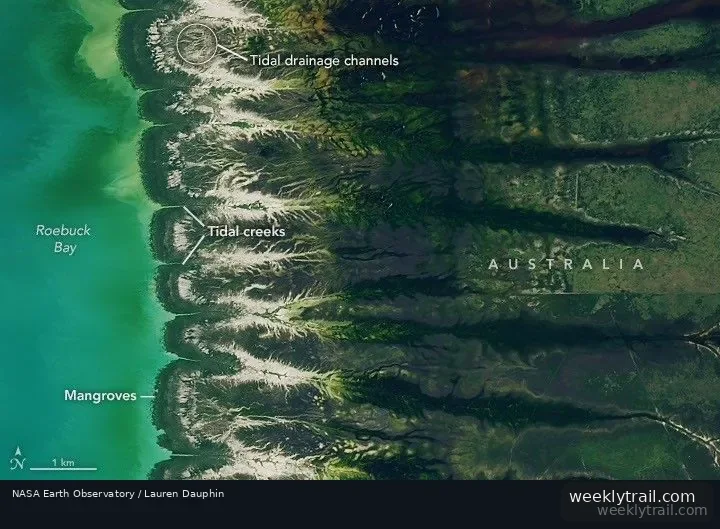
In a report published August 11, 2026, NASA Earth Observatory described Roebuck Bay, a crescent-shaped feature in Western Australia's Kimberley region, where tides and seasonal rains leave visible marks on the landscape. A Landsat 8 image captured on March 18, 2026, showed water covering intertidal mudflats around the bay at high tide. According to the report, the bay's tidal range can reach 9 meters (30 feet), mostly because of northwestern Australia's unusually wide, shallow continental shelf, which amplifies tides near the coast; many parts of Australia have tidal ranges of 2 meters or less.
The report said the bay's mangrove forests are expanding westward by nearly 2 meters per year, based on analysis of decades of Landsat observations, as sediment from waterways to the east accumulates in the sheltered bay. Monsoonal rains, typically between December and March, green the surrounding landscape, while dry-season conditions from May and June turn grasses and sedge ecosystems gold and brown.
The observatory reported that the bay's mangroves serve as nurseries for crustaceans and fish, and that its mudflats host dozens of invertebrate types, including snails, worms, crabs and clams. It said shells and snails can reach an abundance of 2,500 per square meter, according to the Australian government, and that the bay regularly hosts hundreds of thousands of migratory birds along the East Asian-Australasian Flyway.


Start the conversation. A good question is half the story.