 WeeklyTrail
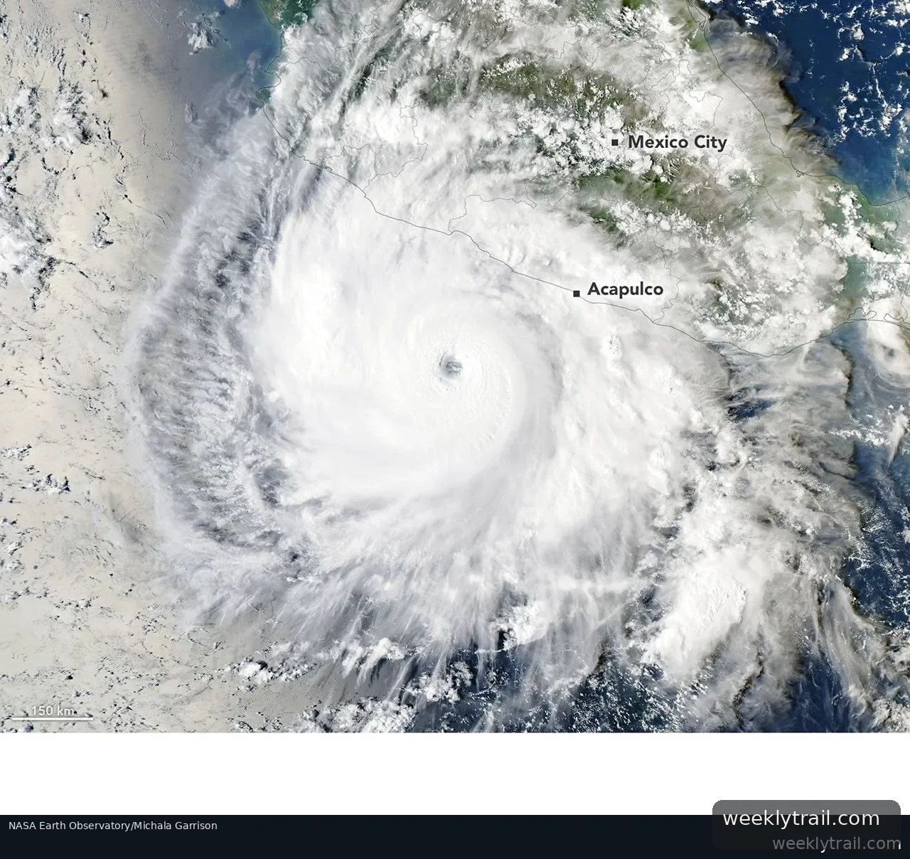
Hurricane Polo formed as a tropical disturbance off Mexico's Pacific coast in mid-September 2026, became a tropical depression by September 20 and a tropical storm the next day, according to NASA Earth Observatory. It then underwent what atmospheric scientist Gary Partyka called "explosively rapid intensification." By September 22, its maximum sustained winds had risen by 90 knots (167 kilometers per hour) in 24 hours, reaching category 5 strength, the National Hurricane Center called the intensification "truly remarkable."
When a NOAA Hurricane Hunter aircraft flew over the storm on September 22, researchers estimated winds of nearly 285 kilometers (180 miles) per hour. According to some analysts, that would make Polo the third-strongest eastern Pacific storm on record by maximum sustained winds and the fastest on record to go from tropical depression to category 5. When NASA's Aqua satellite captured imagery on the afternoon of September 23, Polo was off Guerrero, southwest of Acapulco, at category 4 strength with winds of 230 kilometers (145 miles) per hour after an eyewall replacement cycle weakened it slightly.
Scientists pointed to near-perfect conditions: weak wind shear, high moisture, atmospheric instability and sea surface temperatures as high as 32 degrees Celsius, 2 to 3 degrees warmer than usual for September 23. Partyka and Kristen Corbosiero cautioned against attributing the intensification directly to El Niño, noting past rapid intensification during La Niña and neutral conditions. Forecasters expected Polo to remain over the Pacific until the following week, when it might curve northeast toward Baja California.


Start the conversation. A good question is half the story.