 WeeklyTrail
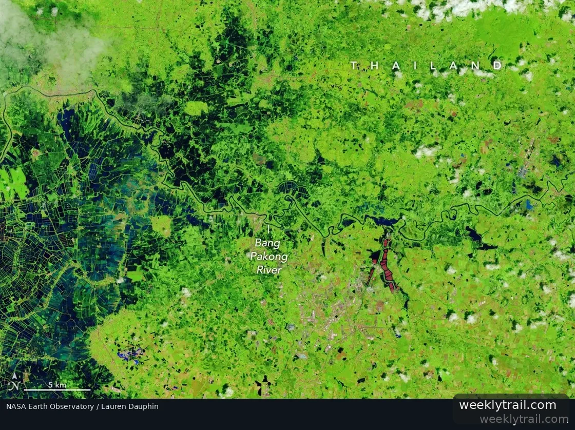
Persistent heavy rains punctuated by intense downpours left low-lying areas across Thailand under sustained flooding in late September and early October 2026, NASA Earth Observatory reported on October 9, 2026. Landsat satellite images of Prachin Buri province, along the Bang Pakong River, showed inundated agricultural land and aquaculture facilities on October 2, 2026, compared with the same area and time of year in 2025. The false-color images were made with NASA-USGS Landsat data.
Some of the flooding likely stemmed from a low-pressure system that stalled over the area for several days in late September, drawing moisture and energy from the nearby Gulf of Thailand. According to news reports cited by the observatory, Bangkok, about 100 kilometers (60 miles) to the west, received nearly 300 millimeters (11.8 inches) of rain over a 48-hour period, close to its September average monthly total of 344 millimeters (13.5 inches).
Citing the International Federation of Red Cross and Red Crescent Societies, the observatory said flooding since mid-September had occurred in 50 provinces, affecting over 4 million people and causing dozens of deaths. Government agencies estimated about 270,000 hectares (670,000 acres) of farmland, including rice fields and fruit orchards, had been damaged.

Start the conversation. A good question is half the story.