 WeeklyTrail
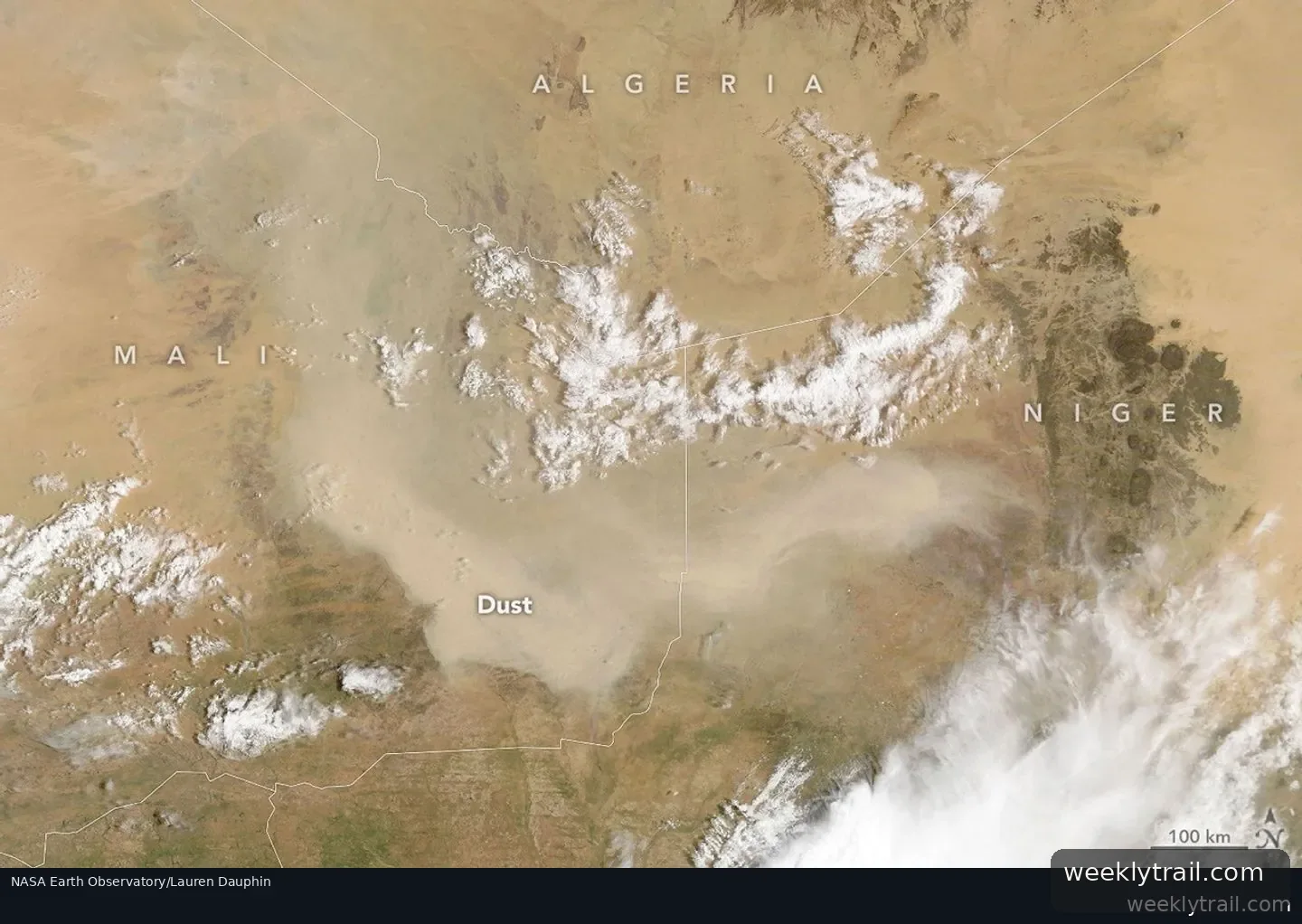
A NASA Earth Observatory report published September 10, 2026 described a dust plume that covered parts of Mali and neighboring countries in early September 2026. The image, acquired September 5, 2026, by the Moderate Resolution Imaging Spectroradiometer on NASA's Terra satellite, showed the dust obscuring the ground. The report noted that the storm came as West African dust activity was winding down for the season, though such events can still occur.
Atmospheric scientist Tianle Yuan of NASA's Goddard Space Flight Center said storms like this are often associated with haboobs, powerful dust storms driven by strong convective winds. In the days after the image was acquired, a wider satellite view showed aerosols from the region moving westward over the Atlantic Ocean, though a full transatlantic crossing was considered unlikely, the report said. Such crossings are more common from late spring through summer, when the Saharan Air Layer can carry dust thousands of miles westward.
Looking ahead, the report said the developing El Niño could reshape these patterns by shifting the Intertropical Convergence Zone and altering convection. Yuan said drier conditions can leave more loose sediment for winds to lift, but less convective activity means fewer haboobs to raise large plumes. He said the connection can be real but is hard to pin down for individual events.


Start the conversation. A good question is half the story.