 WeeklyTrail
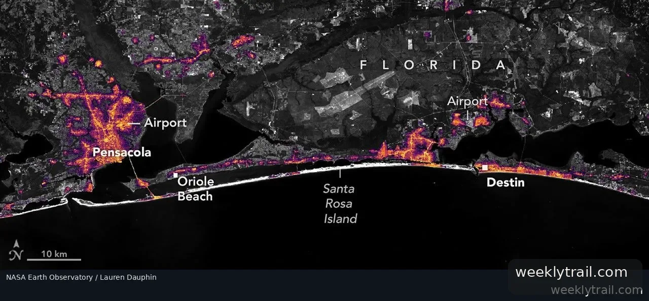
Nighttime satellite imagery shows widespread dimming along the Florida Panhandle after Hurricane Isaias made landfall near Destin on the evening of October 9, 2026, as a Category 2 hurricane with maximum sustained winds of 105 miles (170 kilometers) per hour, NASA Earth Observatory reported on October 16, 2026.
Compared with an August 2026 composite of typical conditions, lights around Pensacola and along the U.S. Route 98 corridor toward Destin appeared sharply reduced on October 11, suggesting widespread power outages. The images come from NASA's Black Marble HD product, which uses VIIRS data from the NOAA-20 satellite over a Landsat 9 base map. Some pockets of light persisted, including Pensacola International Airport, Pensacola Christian College and parts of downtown Pensacola. Ranjay Shrestha of the Black Marble science team said such patterns could reflect backup power or differences in electrical infrastructure, though the imagery alone cannot confirm the reasons.
Lights had begun returning by October 12, and by October 14 lighting patterns looked similar to pre-storm conditions. NASA said Black Marble data complement ground-based outage reports. The agency's Disasters Program is supporting the Alabama Red Cross and the Alabama Emergency Management Agency's response, in coordination with FEMA and the USGS Coastal Storms Team.

Start the conversation. A good question is half the story.