 WeeklyTrail
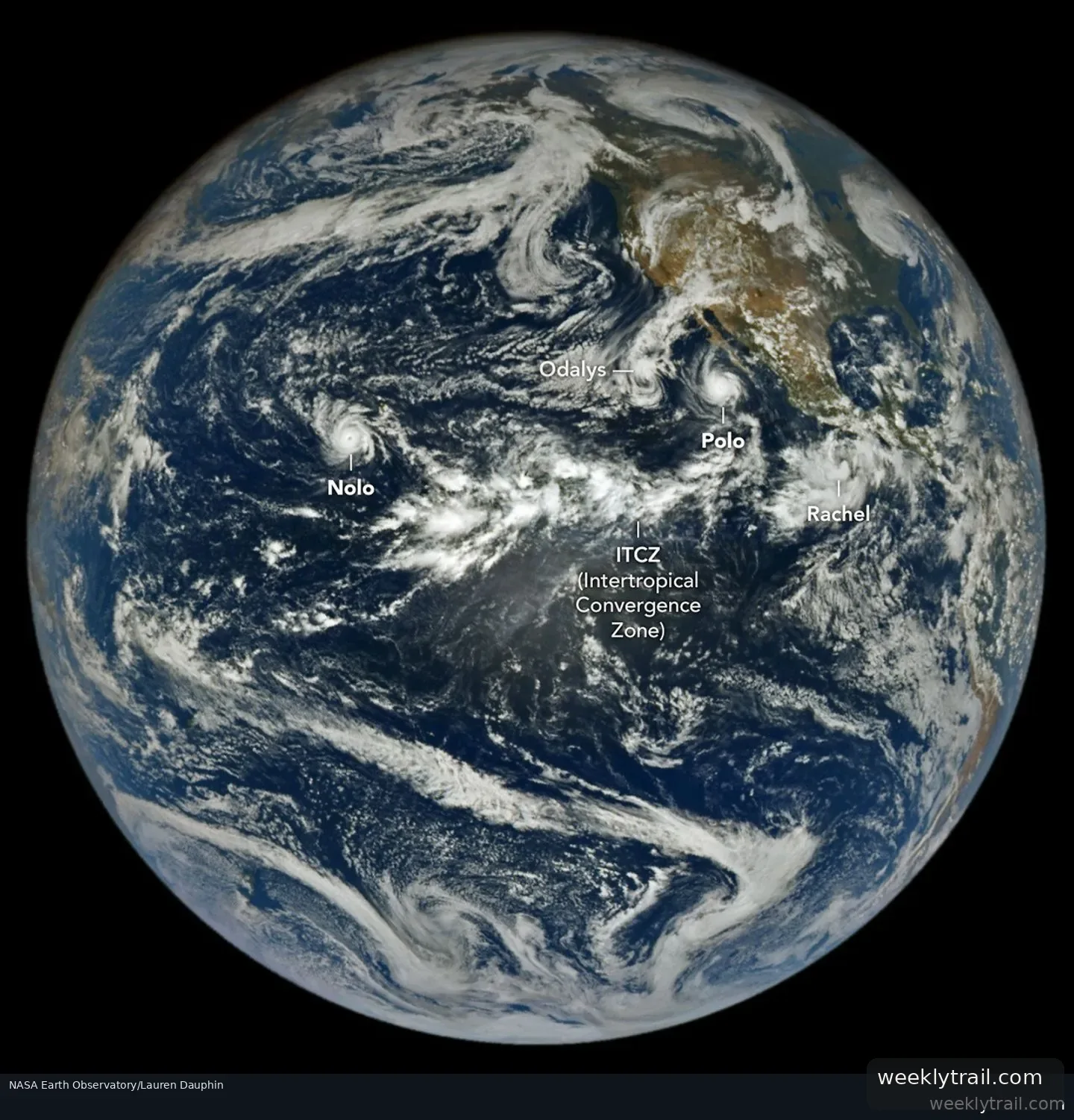
NASA's Earth Observatory reported that the northeastern and central Pacific basins were busy with tropical cyclone activity in an image taken by the EPIC camera on the DSCOVR satellite on September 27, 2026. By September 28, the region had seen 20 named storms, nine of them hurricanes, compared with a 1991-2020 average of 13.5 named storms and 7.4 hurricanes by that date. Hurricane Nolo was near Hawaii and Hurricane Polo off the Baja California peninsula, with Tropical Storm Rachel and Post-Tropical Cyclone Odalys contributing to hazardous conditions along the Mexican coast and in the southwestern U.S.
Polo made landfall in Baja California Sur around 11 p.m. local time on September 28 (06:00 Universal Time on September 29), likely as a category 2 storm after peaking at category 5 on September 22, according to the National Hurricane Center. It made a second landfall near Guaymas around midday on September 29. Forecasters said Polo's remnants, combined with moisture from Odalys, could bring heavy rain and flood risk to the southwestern U.S. and southern Plains over several days.
Nolo did not make landfall but dropped more than 12 inches (30 centimeters) of rain on parts of Maui and the Island of Hawaiʻi, flooding roads and triggering landslides, according to news reports. As of September 28, accumulated cyclone energy in the Northeast Pacific was more than twice the norm, per Colorado State University data. NASA's Disasters Program is supporting Hawaii's response to Nolo in coordination with FEMA.

Start the conversation. A good question is half the story.