 WeeklyTrail
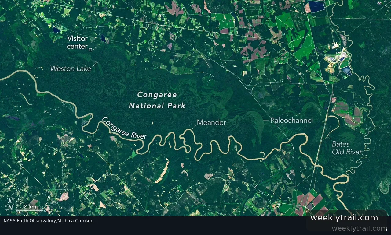
NASA Earth Observatory reported on August 28, 2026, that 80 percent of Congaree National Park in South Carolina lies within the Congaree River floodplain, home to one of the largest intact tracts of old-growth bottomland hardwood forest in the United States. An image taken by the Operational Land Imager on Landsat 9 shows the river winding through forested plain, with bands of green tracing old channels, ridges and swales left as the river migrated. The image was acquired on August 18, 2025.
The observatory described how the river's flat, soft terrain encourages meanders: faster water erodes outer banks while slower water deposits sediment as point bars, and cut-off bends can form oxbow lakes. It cited Weston Lake, listed by the National Park Service as 1.2 miles (1.9 kilometers) from the visitor center, and Bates Old River, a roughly 4-mile-long abandoned channel and one of South Carolina's longest oxbow lakes. Floods, usually in winter and early spring and also after summer and fall storms, spread nutrient-rich silt that helps sustain remarkably large trees. The area became a national monument in 1976 and a national park in 2003.



No comments yet.