 WeeklyTrail
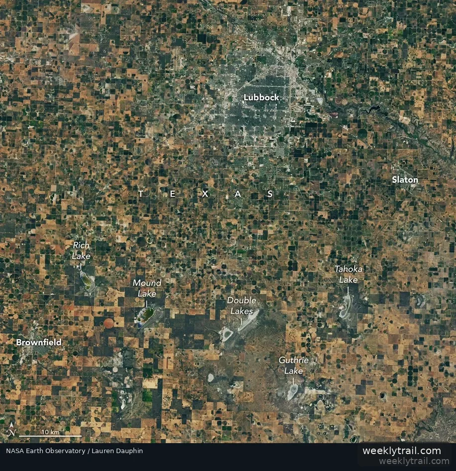
NASA satellite images of Lubbock County show parched brown fields and mostly dry playa lakes in September 2026, compared with greener farmland and part-filled lakes in September 2025. The Earth Observatory published the comparison on October 8, 2026, using imagery from the Operational Land Imager on the NASA/USGS Landsat 8 satellite.
Lubbock County farmer Lacy Cotter-Vardeman told NASA that roughly 90 percent of her dryland cotton had died, a situation she said insurers had never seen. The observations followed past droughts that forced abandonment of large shares of the region's dryland cotton crop, including 72 percent in 2022 and 66 percent in 2011. Groundwater decline in the High Plains aquifer has pushed some farmers to irrigate only part of their fields, while many wells stopped working in August, according to the account.
Rains in September and October brought moisture but not enough to end the drought, NASA Marshall meteorologist Jonathan Case said, citing U.S. Drought Monitor analysis that more than 7 additional inches over three months would be needed. A NASA Acres listening tour visited farms in August, and a Texas Tech study published in September 2026 found playa lakes declined significantly in 15 of 45 counties analyzed since 1995.

Start the conversation. A good question is half the story.