 WeeklyTrail
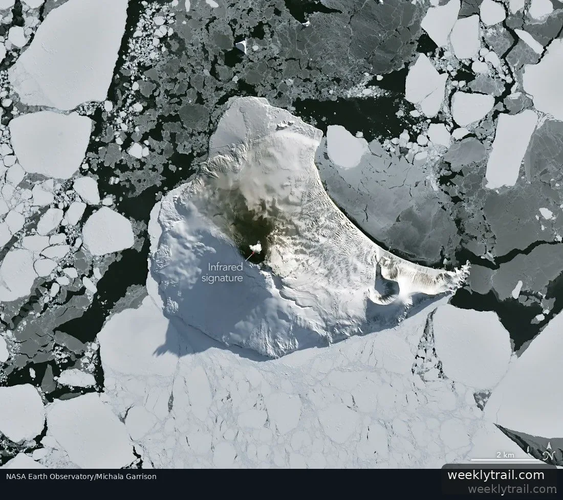
A NASA Earth Observatory report published on September 7, 2026, described an unusually cloud-free satellite view of volcanic activity at Mount Michael, the stratovolcano at the center of Saunders Island in the South Atlantic. The natural-color image, acquired August 24, 2026, with the Operational Land Imager on the NASA-USGS Landsat 8 satellite, was overlaid with an infrared signal shown in red to reveal heat from the summit crater's persistent lava lake. A volcanic plume over the peak and darkened snow on the northern slopes also suggested ongoing activity, according to the report.
Saunders Island is one of the South Sandwich Islands, a chain roughly 350 kilometers (220 miles) long formed by subduction of the South American plate beneath the small South Sandwich plate. The report said an analysis of thermal anomalies in Landsat, Sentinel and ASTER observations spanning 30 years led researchers to conclude that Mount Michael hosts a persistent lava lake, a feature known at only a handful of other volcanoes. MODIS and VIIRS thermal observations and the MIROVA hot spot detection system indicated low-intensity activity had been ongoing for the past several years, and NASA's Aura satellite showed sulfur dioxide emissions are common there.
The clear window closed quickly. When Landsat 9 passed over the island on September 1, 2026, a more active atmosphere had returned, and the 843-meter-high (2,766-foot-high) peak disturbed passing winds to produce wave clouds resembling a ship's wake.


Start the conversation. A good question is half the story.