 WeeklyTrail
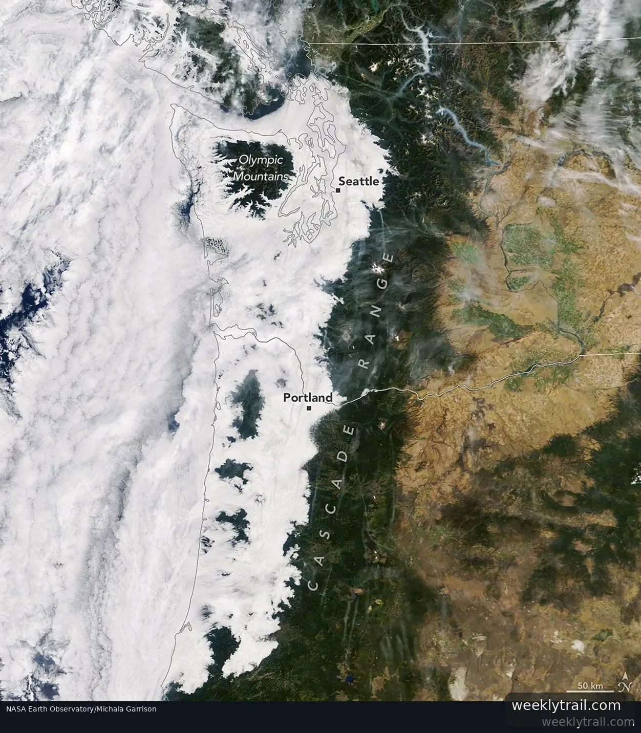
A cool, moist marine air mass moving inland from the Pacific produced a broad layer of low stratus clouds and fog over western Washington and Oregon in mid-September 2026, according to NASA Earth Observatory. The clouds extended as far inland as the western foothills of the Cascade Range. Near the coast, taller parts of the Olympic Mountains in Washington and the Oregon Coast Range rose above the layer like islands.
The MODIS instrument on NASA's Terra satellite captured the scene on September 19, 2026, at about 10:45 a.m. Pacific Time (17:45 Universal Time). The image also shows extensive cloud offshore over the Pacific and smoke from wildland fires in valleys of the North Cascades.
Citing the National Weather Service, the observatory said marine air flowed onshore for several nights in a row, bringing low-level marine stratus. Such clouds form when moist surface air trapped beneath a warmer layer in a temperature inversion cools enough for water vapor to condense. The surge was especially strong early on September 19, with some areas seeing fog where clouds reached the ground. By the time NASA's Aqua satellite passed at about 4:15 p.m. Pacific Time, skies had cleared over much of the area, though some marine clouds lingered along the cooler Oregon coast.

Start the conversation. A good question is half the story.