 WeeklyTrail
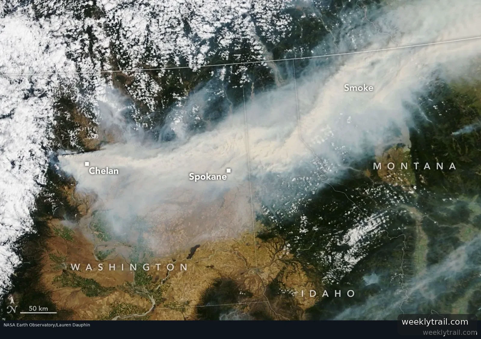
NASA Earth Observatory reported on August 4, 2026, that wildland fires burning in eastern Washington in early August had pushed air quality to unhealthy levels, destroyed hundreds of structures and triggered mandatory evacuations in Spokane.
In an image captured on August 2, 2026, by the MODIS instrument on NASA's Terra satellite, smoke from the fires streamed east-northeast into Idaho, Montana and several Canadian provinces. At that time, the Little Giant fire west of Chelan had burned more than 38,500 acres (15,600 hectares) and was zero percent contained, according to its incident management team. The Spokane Area fires, which ignited the day before, had burned around 5,400 acres; by the morning of August 3, InciWeb put that figure at more than 8,000 acres. Preliminary reports indicated more than 600 structures had been destroyed or damaged, with mandatory evacuation orders in place for parts of Spokane and Stevens counties.
According to the Washington State Department of Natural Resources, more than 1,000 fires had burned about 425,000 acres since the start of 2026, the most since 2021, and 12 large fires remained active.

No comments yet.