 WeeklyTrail
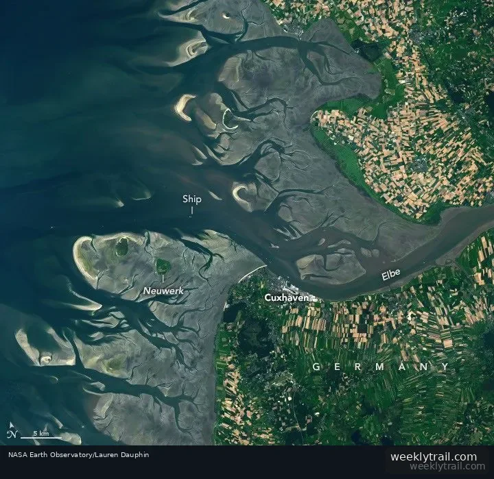
NASA's Earth Observatory reported on August 6, 2026, on Landsat 9 images acquired at low tide on August 15, 2025, and at high tide on May 11, 2025, showing how tides reshape the Elbe estuary on Germany's North Sea coast. The Elbe runs more than 1,000 kilometers across Europe before reaching the sea.
The observatory reports a mean tidal range at Cuxhaven of 2.9 meters (9.5 feet), described as intermediate, or mesotidal. Because the flood period is shorter than the ebb, the observatory says, the incoming current runs faster and typically carries more sediment up the 140-kilometer estuary than out. The surrounding tidal flats are part of the Wadden Sea, which the observatory describes as the world's largest continuous system of intertidal sand and mud flats and a stopover for more than 10 million migratory birds each year.
The report notes that a dredged channel lets ships reach Cuxhaven and Hamburg, and that some vessels can pass only at sufficiently high tide. It cites a highest water level at Cuxhaven of 5.1 meters (16.7 feet) above Europe's official sea level reference, measured on January 3, 1976, and a sea-level trend there of 2.12 millimeters per year (0.70 feet per century).



No comments yet.